Climatic conditions of the Far East. Natural and climatic conditions of the Far Eastern Federal District Climatic records of the Far East
Dangerous, unfavorable weather phenomena.
- On March 18, in the north of Kamchatka Territory, heavy snow, blizzard, wind 17-22 m / s. March 18-20 on the coast of Chukotka autonomous region snow, blizzard, wind 15-20 m / s, on the coast up to 32 m / s. On March 18-20, in the north of Yakutia, snow, blizzard, wind 15-20 m / s, on the coast 20-25 m / s, on March 19 24-29 m / s, on March 20 up to 25 m / s. On March 19-20, in the Primorsky Territory, heavy precipitation (snow, rain), wind 9-14 m / s, on March 20 at the coast up to 27 m / s. On March 20, in the south of the Kuril Islands, the wind is up to 21 m / s.
- March 18. In the Trans-Baikal Territory, the wind is 25-28 m / s.
- March 18-20. On the coast of Yakutia, snow, blizzard, wind 20-25 m / s (March 19 to 29 m / s). Snow, blizzard, wind 28-33 m / s on the coast of the Chukotka Autonomous Okrug. In the north of the Kamchatka Territory, snow (heavy on March 19), blizzard, wind 15-20 m / s (March 18 up to 22 m / s).
- March 19-20. In the Primorsky Territory there are heavy precipitations, on March 20 on the coast the wind is up to 27 m / s.
- 20th of March. There is snow on Sakhalin, wind is 15-20 m / s. In the south of the Kuril ridge, rain, wind 16-21 m / s.
- ✔ Unstable spring weather persists in the Far East.
- ✔
The constantly changing nature of the weather in the Far East corresponds to the season. The entire past week has been windy and snowy for the coastal regions.
In the coming weekend, unstable weather persists in Kamchatka; active cyclonic eddies, which bring bad weather, continue to arrive from the southern latitudes with a short break. Heavy snow and hurricane winds are still possible on the coming night. In the south of the peninsula 17-22 m / s, in the western regions and in the southeast up to 25-30 m / s. But, tomorrow afternoon, March 14, the intensity of precipitation will decrease. Cloudy weather with clearings is expected, light, moderate snow in places. The wind will subside to 9-14 m / s, only at night on the coast to 20 m / s. And while the abnormal heat lasts. At night, only -3 ...- 8 °, only with clearings down to -15 °. In the daytime 0 ...- 5, in some places up to +5. Ice on the roads. On Monday night, another southern cyclone will approach and precipitation will intensify, but it will remain warm.
All bad weather from the Kamchatka Territory is directed to the Chukotka District. On Saturday, March 14, it will snow here, in places in the form of sleet. Southwest wind 8-13 m / s, gains 18-23 m / s and a blizzard. On Saturday night, gusts up to 28-33 m / s on the coast of the Chukchi and Bering seas. And unusually warm air for mid-March. In the east of the district -3 ...- 8 ° frost in some places -1 ... + 4 °. In the rest of the territory -13 ...- 18 °, at night in the west in the continental part of the traditional frost is up to -33 ...- 38 °.
On the Kuril Islands, after a hurricane wind, tomorrow afternoon, a short break. The sun will pass through and warm up to + 1 °. But on Sunday night, another active cyclone will bring precipitation, a blizzard and the wind will again increase to 25-30 m / s.
On Sakhalin, the weekend will be more relaxed. The sun will appear, but in some places a little snow is possible. Background night temperatures range from -25 ° in the north to -6 ° in the southwest of the island. During the day, a weak minus -1 ...- 6 °.
Windy weather remains on the coast of the Magadan Region, on Saturday in some places up to 25-30 m / s. Light snow will fall in some areas. The rest is unchanged. At night in the central regions it is frosty-27 ...- 32 °, with clearings it drops to -42 °. In the afternoon, it is already warming up to -12 ...- 17 °. On the Okhotsk coast -15 ...- 20 ° at night and up to -7 ° during the day.
The weekend in the Khabarovsk Territory will be calm. No significant precipitation is expected. With a moderate wind at night -12 ...- 17 °, in the mountains in the north up to -35 °. In the daytime, a little frost -1 ...- 6 °.
Light snow will fall in Primorye. The temperature is consistent with the season. At night -9 ...- 14 °, in mountainous areas up to -20 °, on the coast it is warmer -3 ...- 8 °. During daylight hours 0 ... + 5 °, in the north up to -3 °. On Sunday, a cold air mass will drop, which will lower the temperature by 2-3 degrees.
In the continental regions of the Far East, there is an area of increased pressure. There will be more sun here in the coming days. Only in the western regions of Yakutia atmospheric fronts from Siberia will bring light snow and warming. On March 14, the maximum temperature is -14 ...- 19 °, in the west of the republic -5 ... 10 °. At night -23 ...- 28 °. The cold persists only in the northeastern regions up to -42 ...- 47 °.
Light snow and windy in Transbaikalia. On Saturday in some places gusts up to 20 m / s. The air temperature will rise. And by Monday, even at night, it's already only -5 ...- 10. In the east of the Trans-Baikal Territory, frost will still hold up to -22 °. During the day, plus values +1 ... + 6, in Buryatia up to +11 heat.Weather news from 03/10/2020
- ✔ The eastern regions of Russia are dominated by an active cyclone.
- ✔
Bad weather has already covered the south of Primorye. Snowfalls began, in places strong, the wind increased up to 18 m / s. Ice and snow on the roads. Tomorrow, March 11, in the region there is little, moderate snow in some areas, at night in the east in some places it is heavy. Air temperature at night -2 ... -7 °, in the north up to -14 °, in the daytime -2 ... + 3 °. But already on Friday, March 13, a new atmospheric front will approach Primorye, which will bring snow again and become 3-5 degrees cooler ...
The southern cyclone is already affecting the weather and the Far Eastern islands. In the next few hours on March 10, with the preservation of the night of March 11 in the southern regions of Sakhalin, as well as at night and during the day of March 11 in the northern and central regions of Sakhalin, heavy (6-19 mm) and very heavy (20 mm or more) snow is expected, a heavy blizzard (visibility 500 m or less). Wind 17-22 m / s, on the coasts 25-30 m / s, gusts up to 33 m / s. In the mountains it is avalanche dangerous, in the southern regions sticking of wet snow. The temperature for the next few days is slightly above normal. The warmest day is March 13, in the south of the island up to +3. At night -10 ...- 3 °.
On the Kuril Islands from March 11 to 13, precipitation, in places strong, in the north there is snow, a stormy wind in the southerly direction, with an increase of up to 27-32 m / s. The temperature during the day is -1 ... + 4 °.
Tomorrow the southern cyclone will enter the Sea of Okhotsk. Weather conditions are expected to deteriorate in coastal areas. March 11 in the east Khabarovsk Territory heavy snow, blizzard, wind 21-26 m / s on the coast of the Tatar Strait. The next three days, the background of night temperatures will be in the range from -12 to -17 °, in some places -22 ...- 27 °. On Wednesday afternoon, -2 ... + 3 °, in some areas -7 ...- 12 °, further with a cooling of 3-5 degrees.
Tomorrow, March 11, in the Magadan Region, the weather is still calm, mostly without precipitation. It is frosty at night, in the continental regions -30 ...- 35 °, in the afternoon it already warms up well to -15 ...- 20 °. In coastal areas it is warmer, -15 ...- 20 ° at night and during the day up to -7 °. However, on Thursday night an active cyclone will get here too. And it will bring snow, strong in places, a blizzard and increased wind up to 27-30 m / s. And the thermometer will rise by 3-4 degrees.
The weather in Kamchatka will change according to the same scenario. Tomorrow afternoon it is warm and sunny, but in the late afternoon, starting in the southern regions, the peninsula will begin to deteriorate.
Storm warning issued. From 00 to 12 o'clock (Moscow time) on March 11 in Ust-Bolsheretskiy, Sobolevskiy districts of Kamchatka Territory heavy snow is expected, southeast wind 25-30 m / s.
From 12:00 to 00:00 (Moscow time) on March 11, it will remain in Ust-Bolsheretsky, Sobolevsky districts, spread to Petropavlovsk-Kamchatsky, Elizovsky, Milkovsky, Ust-Kamchatsky, Bystrinsky, Aleutsky, Tigilsky, Karaginsky districts: heavy wet snow is expected, a blizzard, in in mountainous, foothill areas, wet snow adhesion, ice on the roads, snow drifts, south wind 15-20 m / s, in coastal areas 25-30 m / s.
From 00 to 12 o'clock (Moscow time) on March 12, heavy snow, a blizzard will persist in the Karaginsky region, spread to the Olyutorsky, Penzhinsky districts; In Petropavlovsk-Kamchatsky, Sobolevsky, Ust-Bolsheretsky, Elizovsky, Ust-Kamchatsky, Aleutsky, Karaginsky, Olyutorsky, Penzhinsky districts, the southern wind is 25-30 m / s.
And it will get warmer by March 12 in the daytime to +6, at night from 0 ° in the south to -8 ° in the north of the peninsula.
At the end of the week, residents of Chukotka will also feel the influence of this cyclone, but tomorrow the weather is still happy. It will be sunny and dry. With a moderate wind, the air temperature will be in the range from -15 ° on the east coast to -40 ° in the continental part.
Already another cyclone from the west will bring snow, blizzard, wind 18-23 m / s (March 11 to 27 m / s) to the Arctic coast of Yakutia on March 11-12.
In the rest of the republic, the background of atmospheric pressure is increased, it will be clear, for the most part without precipitation, only in the south on Wednesday, March 11, moderate snow.
The air temperature is different. The coming night in the central regions is -25 ...- 30 °, with snow -17 ...- 22 °, in the south it is warmer -10 ...- 15 °. In the west, frost is -35 ...- 38 °, in the northeast to -47 °. In the daytime, the thermometer will warm up to -12 ...- 17 °, in the south of the republic -3 ...- 8 °. It is coldest in the northeast, where even on a sunny March day it is only -23 ...- 28 °.
Tomorrow, March 11, it is still sunny in the Amur Region, but on March 12, the atmospheric fronts will bring snowfalls and an increase in wind up to 20 m / s. The air temperature is slightly above normal -15 ...- 20 ° at night and thaw in the daytime -2 ... + 3 °.
Weather news from 13.3.
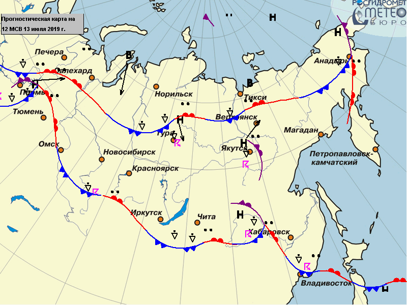
Far East weather maps and satellite imagery.
Forecast maps → forecasts for five days.
Above, for clarity, screenshots of the maps "precipitation and pressure", "surface temperature" (t ° at a height of 2 m above the earth's surface), "temperature T850 (° C) and geopotential H850 (dam)".
Click on any picture »View the map
and see it in an enlarged size and already with real predictive data. Far East, weather on the map today and forecast. The interval between the lead times of forecasts is 6 hours.
 On the relevance of maps of meteorological fields.
"Weather Russia" updates the data on the maps twice a day, plus a forecast from 6 to 120 hours is available. As a result, you can get acquainted with the official, reliable ("firsthand") weather information (precipitation, pressure, temperature, hot and cold hot spots, cyclones ...) directly for your federal district (region) and lead time 5 days.
For clarity, an animation was made for five days from the maps of precipitation and pressure (Far East).
Click according to the animated image.


- Below are links to satellite images.
- There is a wide variety of images, for example, according to the observation areas, the size of the images, the time of their release, the frequency of updating, etc. They will be useful mainly for those who want to see cloudiness from a satellite today, in real time ...
- The review includes images showing not only the territory of the Far East separately, but also global observations. See the weather from satellites.
- Digital montage of images over the territory of the Far Eastern region in stereographic projection. Satellite images are released more than 20 times a day (hourly)
- Global satellite map of cloud cover. Digital montage of images over the tropical visibility zone from geostationary satellites in the infrared range, Mercator projection. Cloudiness on the map around the world
»Global map of cloud cover from satellite - Global cloud map for the northern hemisphere. Digital montage of images in the northern visibility zone from geostationary satellites in the infrared range. Polar stereographic projection
»Global cloud map for the northern hemisphere - Operational satellite data from geostationary satellites MeteoSat. Cloudy - Europe, Asia. Satellite images are updated in 6 hours
The territory of the Far East is located along the Pacific coast for more than 4500 thousand km. from Chukotka to the border with Korea. The northern part of the region is located beyond the Arctic Circle, therefore, snow cover persists even in summer. The southern territories are located at 40 latitudes - among the spruce groves, subtropical plants are often found here.
Nature
This region is characterized by contrasting phenomena and processes that are caused by the interaction of various air masses, cold and warm air masses, as well as the junction of lithospheric plates. All this became a prerequisite for the formation of variegated natural conditions.
The Far Eastern region is located on the collision line of the Pacific and Eurasian plates, which resulted in the formation of mountain systems that stretch parallel to the ocean.
Most of the mountain ensembles of the Far East were formed back in the Mesozoic, but mountain-building processes continue to this day, as evidenced by systematic earthquakes in this region.
Climatic conditions
The contrasting climate of the Far Eastern region is predetermined by the interaction of sea and continental air masses of the temperate zone. Due to the cold airflow from the Asian High, winters in the region are harsh and frosty.
Under the influence of warm flows from the ocean in winter, a large amount of precipitation falls here, sometimes the thickness of the snow cover reaches 2 m.
Summers in the region are quite warm, but monsoon rains fall here every day. Many rivers of the Far East, in particular the Amur, begin to flood in the summer, since due to the protracted spring, the snows melt gradually.
Relief, flora and fauna
A complex relief system, a combination of various air masses and closed basins are the factors that lead to the diversity of the vegetation cover of the Far Eastern region. The flora includes species typical for both cold Siberia and hot Asia.
Here are spruce coniferous forests side by side with impenetrable thickets of bamboo. In the forests you can find lindens, spruces, hornbeams, pears, pines and nuts. Dense thickets of broad-leaved forests are entwined with lianas, lemongrass and grapes.
The Far Eastern fauna is also very diverse: reindeer, squirrels, sables, elks, which belong to Siberian species, as well as black deer, raccoon dogs, and Amur tigers live here.
Economy of the region
Vivid contrasts are characteristic and for the economy of the region. Industry and agriculture are well developed in the Far East. In the central and southern part, rice, potatoes, soybeans, legumes, wheat and a variety of vegetables are grown.
Also, the south of the Far East specializes in gardening. In the northern part of the region, expensive furs are manufactured. Fishing predominates in coastal areas.
In the depths of the Far Eastern region, there is a large-scale ensemble of minerals that are rarely found on the same territory: copper, non-ferrous and iron ores, gold, phosphorites, oil, natural gas, apatites and graphites.
General characteristics of the climate of the Far East
From a geographical point of view, the Far East is the most remote point in the country from the capital. The Far East includes:
- Chukotka,
- Yakutia (Sakha),
- Kamchatka Krai,
- Khabarovsk region,
- Primorsky Krai,
- Magadan Region,
- Amur region,
- Sakhalin region,
- Jewish Autonomous Region.
The territory is located on the outskirts of the Asian continent and Russia.
The elongation of the territory determined the contrast of the climate from sharply continental in the north to monsoon in the southeast. The climatic differences between the north and south are the result of the interaction of the Pacific Ocean and its seas with the land of the northern part of Asia, as well as the complex mountainous relief.
In winter, cold air streams rush to the southeast from the powerful Asian maximum.
In the northeast, the continental air of Eastern Siberia interacts with the warm sea air. The result of this interaction is cyclones that carry abundant precipitation.
Remark 1
Snow, which falls on Kamchatka and Sakhalin, can reach a height of 6 m.
Finished works on a similar topic
- Coursework 430 rubles.
- abstract Climatic conditions of the Far East RUB 250
- Test Climatic conditions of the Far East RUB 200
In the summer, the Far East is characterized by monsoon rains, which are a consequence of the interaction of sea air masses with continental ones. The monsoon climate covers the Primorsky Territory and the Amur Region, so the Amur River floods not in spring, but in summer.
The moderate monsoon climate is characterized by dry, frosty, sunny winters, and only on the coast can there be sharp gusty winds and fogs. January temperature averages -22 ... -24 degrees.
In Southern Primorye and Sakhalin -10 ... -16 degrees. Little snow falls.
A warm humid monsoon starts blowing from the ocean in the month of June and a warm but rainy and windy weather sets in.
The first half of summer is cloudy with rain and high humidity. The second half of summer is very favorable and average temperatures of +17, +22 degrees are kept almost until October.
In the interior regions, precipitation is 500-550 mm, on Sakhalin and the Pacific coast - 700-750 mm. In mountainous areas, their number increases to 800-900 mm.
Tsunamis, avalanches, mudflows, storms and typhoons are possible on Sakhalin and Primorye.
The coast of the Arctic Ocean is in the zone arctic climate... The territory receives a small amount of solar radiation, so winter temperatures are -32 degrees, and summer temperatures are 0, +4 degrees. Precipitation falls here 100-300 mm.
To the south, the arctic climate is replaced by a subarctic climate, within which part of the Verkhoyansk and Chersky ridges, as well as the Koryak and Kolyma highlands are located.
Temperatures here are abnormally low -48 degrees in winter and +12 degrees in summer. Annual precipitation is 200-400 mm. Verkhoyansk and Oymyakon, the cold poles of the Northern Hemisphere, are located within the subarctic.
The sharply continental climate of the temperate zone covers the southwestern part of the Far East - these are the Central Siberian Plateau and the Aldan Plateau. Winter temperatures in this area drop to -32 ... -48 degrees, and summer temperatures are quite high +12, +20 degrees. Annual precipitation is 300-500 mm.
Chukotka climate
Chukotka is located within the subarctic climatic zone. Its coast is in the area maritime climate and the hinterland lies in the continental climate.
Chukotka is characterized by a complex atmospheric circulation, which is different in the warm and cold seasons.
Chukotka is located in the zone of influence of 2 oceans. Much of it is located outside the Arctic Circle, where the climate is much more severe than in neighboring Alaska.
Winter is long and windy in the east, and very cold in the west. The summer period is short and cool. The weather here is very changeable, for example, during the day, atmospheric pressure drops are 50 Mbar, and winter temperature drops are -30 degrees. Permafrost is everywhere.
Average temperatures throughout the year are negative and decrease from south to north from -4 to -12 degrees. The harsh winter period lasts 9 months.
The severity is facilitated by the proximity of the cold pole - Oymyakon and the Arctic Ocean.
The daily temperature of the coldest winter month, January, varies from -15 to -39 degrees. The absolute minimum is -61 degrees. The Northern Lights are often seen in winter.
Daylight hours begin to increase from the end of January, and in February the Sun is high above the horizon.
The beginning of the calendar spring is March, but in Chukotka not only March, but also April and May are truly winter. The snow begins to melt at the end of May, and the air temperature rises to -6, -8 degrees.
The real Chukchi spring comes in early June, with which come powerful fronts of breezes, precipitation and fog.
The summer period is cold, rainy and short, starting from mid-June.
Summer is characterized by frequent weather changes associated with the interaction of circulation factors - a low pressure is established over the peninsula, anticyclones over the Pacific Ocean and cyclones over the coast of the Arctic Ocean.
July, as expected, is the warmest summer month, with a daytime temperature of +13 degrees, and on the coast only +7 degrees.
In the western part of the Chukchi Sea coast, the daytime temperature does not rise above +5 degrees. There are also exceptions - hot weather with a temperature of +30 degrees can come in the interior.
In August, nature begins to prepare for winter, the daytime temperature ranges from +8 to +16 degrees, the sun warms less, the tundra turns yellow.
Autumn lasts about a month and winter comes in the second half of September. Precipitation falls here about 500-700 mm and most of them are on the coast.
Climate of Primorsky Territory
Primorye is located within the temperate monsoon climate. On the one hand, it is greatly influenced by the Pacific Ocean, and on the other hand, by the continental regions of Eurasia.
In the north of Primorye, winter begins in early November, and in mid-November it comes to the south of Primorye and lasts from 130 to 160 days. Only in the northern part of the region and in the foothills of the Sikhote-Alin, its duration increases to 180 days.
Winter weather is dry, clear and frosty with frequent thaws. On these days, the daytime temperature can rise to + 7 ... + 12 degrees.
With the exception of the southern coast in November, the temperature throughout Primorye ranges from -4 to -13 degrees, winds begin to blow, the speed of which reaches 15 m / s, and a snow cover forms.
Sikhote-Alin is a natural border between the eastern and western regions, so the southern and eastern coasts are warmer in winter.
The daily average January temperature on the coast is -14 degrees, and on the mainland -12 ... -23 degrees. The absolute minimum was registered here in the Krasnoarmeysky district and amounted to -54 degrees. Precipitation occurs in the second half of winter, but there are few of them.
The air temperature in March is -4 ... -9 degrees, on the coast -1 ... -3 degrees. Snow melts in the first half of April, when the daytime temperature on the continent is +7, and on the coast +12 degrees.
During June, summer comes to the entire territory of Primorye. In the continental part of Primorye, the first half of summer is hot and dry, while on the coast it is wet and cool.
The second half of summer is hot with abundant rainfall. July temperature +25 degrees and an absolute maximum of +41 was registered in the Pogranichny district.
On the coast and the eastern slopes of the Sikhote-Alin, the June daytime temperature is +15 degrees. With distance from the coast, the temperature rises to +20 degrees.
July and August are monsoons and it can rain without interruption for 2-3 days.
Autumn in the north of the region begins in early September and comes to the south by the middle of the month. Autumn weather is warm and dry. The daytime temperature in the continental part is +16 degrees, on the coast +11 degrees.
At the end of November, when the air temperature drops to 0 degrees, winter comes.
Climate
general characteristics
Russia is a country with a relatively cold climate. Its territory is located in four climatic zones: arctic, subarctic, temperate and subtropical. The arctic and subarctic belts include the seas Arctic Ocean, the arctic islands and the northern continental outskirts of the country. Most of the territory is in the temperate zone, a small area Black Sea coast of the Caucasus and the south coast of Crimea- in the subtropical. The climate is formed under the influence of arctic, temperate (polar) and tropical air. The enormous length of Russia from north to south leads to large differences in the values of the arrival and consumption of solar radiation. Depending on the geographical latitude, the amount of solar radiation coming to the earth's surface per year varies from 2400 MJ / m2 in the north (in some places less, for example, on the islands of the Arctic Ocean) to 4800 MJ / m2 in Caspian lowland and the Black Sea coast of the Caucasus. In the cold season in most of the country, the scattered radiation is slightly higher than the direct or approximately equal to it. In the warm season, direct radiation prevails everywhere (with the exception of the Arctic, where, due to large, but thin cloudiness, scattered radiation also prevails in summer). The radiation balance for the year is positive throughout the entire territory, varying from 2100 MJ / m2 in the south of the country to values close to zero in the center of the Arctic (on the northern continental margin 400 MJ / m2)). Significant changes in the latitudinal distribution of solar radiation are associated with cloudiness. The greatest deviations of the total radiation are noted in the west and north-west of the European territory, where the role of cloudiness is great throughout the year, and in the Far East in the summer, when cloudiness increases due to the influence of sea air masses. Its maximum values are observed in May - June at the highest heights of the Sun, a long day, and little cloud cover. The lowest values are in the winter months, when the Sun's elevation is at its lowest, the length of the day is small, and the cloudiness is significant.
Almost everywhere the climate is continental. The degree of continentality increases markedly in the direction from west to east (in Western Siberia from north to south) as the influence weakened Atlantic Ocean... In most of the country, continental air of temperate latitudes is formed, which is the predominant air mass throughout the year. The Arctic belt is constantly dominated by the Arctic air masses, in the subarctic zone, temperate air prevails in winter, and arctic in summer. Cyclonic activity (see. Cyclone) develops on the Arctic front (delimits the arctic air and the air of temperate latitudes) and the polar front (separates the air masses of temperate latitudes and tropical ones). Most of the territory is characterized by the predominance of latitudinal air mass transfer - from west to east, but in winter with a noticeable southern component, and in summer - with a northern one. Cyclones bring major precipitation. IN winter time continental air is significantly cooled, this is facilitated by small amounts of solar radiation and snow cover, which occupies most of the territory. It is especially strongly cooled in Eastern Siberia, where a vast area of high atmospheric pressure is established in winter - the Siberian anticyclone ( Asian anticyclone) with clear and dry weather. In summer, the air here warms up strongly due to the long duration of sunshine and insignificant cloud cover. The climate of Eastern Siberia is sharply continental. In the summer period in the European territory, the air warms up especially strongly in the steppe zone (the Volga region and the Caspian lowland). Favorable conditions are created here for its transformation into a dry subtropical; this is associated with frequent dry winds, sometimes dust storms. The European part of Russia is influenced by the Atlantic Ocean throughout the year, so the climate here is moderately continental - the annual amplitude of air temperature does not exceed 30–35 ° C. In summer, the sea air comes already partially transformed into continental air. In winter, it penetrates further to the east, as large clouds and the absence of a stable snow cover on the shores of the Baltic Sea slow down its cooling and transformation. As we move to the east, the annual air temperature amplitudes increase: in Western Siberia - up to 40–45 ° C, in Eastern Siberia - up to 65 ° C (the highest in the Northern Hemisphere), the amount of precipitation decreases. On the coast of the Sea of Okhotsk, the annual amplitude decreases again - to 30–35 ° C, in the Vladivostok region - to 28–30 ° C, the amount of precipitation increases. The climate of the Far East is formed under the influence monsoon circulation... The winter monsoon comes from the north and northwest and forms a dry cold weather... The summer monsoon brings humid Pacific ocean air from the south and southeast. Invasions of cold Arctic air masses are frequent on the territory of Russia, especially in the eastern regions of the European part of Russia and in Western Siberia, where they can penetrate far to the south. In winter, they are associated with strong drops in temperature. In late spring and early autumn, such invasions cause frosts. In summer, the Arctic air warms up rather quickly, dries up and transforms into dry continental air of temperate latitudes, which can cause droughts in the Volga region. In winter, almost the entire territory is under the influence of high atmospheric pressure. Reduced pressure is created only in the north-west of the European territory and in Kamchatka where the repeatability of the passage of cyclones is high. At this time of the year, westerly and south-westerly winds prevail almost throughout the entire European territory, in Western Siberia - southwestern and southern, in Eastern Siberia - weak northeastern (in the northern part), southern and southwestern (in the southern part ). In summer, the air pressure is mainly low, in the European territory and in Western Siberia north-westerly winds prevail, in Eastern Siberia - northern and northeastern winds. On the coasts of the Sea of Japan and Okhotsk, in Amur region, on the Sakhalin and Kamchatka, the winds of a monsoon character are sharply expressed (in cold weather the prevailing direction is from land to sea, in warm weather - from sea to land). The strongest winds (up to 10–15 m / s) are recorded in the interior regions during the transitional seasons, and on the coasts in winter. In summer they are weaker (2–5 m / s). As the distance from the coasts increases, the wind speed decreases.
Air temperature. The coldest month of the year in the continental part of Russia is January, on the shores of the seas - February. The lowest air temperatures are observed in Eastern Siberia, in the region of Oymyakon and Verkhoyansk; the average monthly temperature in January is –50 ° C, the minimum is –68 ° C. From this cold pole of Eurasia, the temperature rises most sharply to the shores of the seas. The average January temperature on the shores of the Bering and Okhotsk Seas increases to –22 ° C, in the south of Kamchatka - to –10 ° C, in the Vladivostok region - to –14 ° C. In the southern part of Siberia, the average January temperature is from –14 to –16 ° C. In the European territory, the coldest region is the northeast (Pechora basin), here the average January temperature is from –18 to –20 ° C, in the center and northwest from –10 to –12 ° C, in the south of the Volga region from –4 down to –6 ° C. From February (on the shores of the seas from March) the air temperature rises and grows until July - August. July throughout the territory is the warmest month. The coolest this month is on the coasts of the Arctic seas. In the center of the European part, in Western and Eastern Siberia, the average July temperature is 15–20 ° C, in the lower reaches of the Volga up to 25 ° C, in the Far East 12–16 ° C. The duration of the frost-free period varies from 45-60 days in the tundra to 270 days in the Sochi region. Spring and autumn frosts cause great damage to agriculture, due to which almost the entire territory of Russia belongs to the zone of risky farming. The earliest end of frost is observed in spring on the Black Sea coast of the Caucasus - in late February - early March, and in Yamal and Taimyr they end only in late June - early July. The latest frosts in autumn - on the Black Sea coast of the Caucasus - in late November - early December.
Relative humidity is distributed in accordance with the air temperature, its values increase with decreasing temperature. The highest values of humidity are observed in the tundra (70%) and forest zone (50-60%), the lowest - in the steppe zone (40-50%; in the southeast of the European territory, in dry steppes - up to 30-40%).
Cloudy. The highest cloud cover, except for Eastern Siberia and the Amur region, falls on November - February, the smallest is observed in July - August, but on the coasts of the Arctic seas, in Eastern Siberia, and especially in the Far East, it is also high in summer.
Precipitation. The greatest amount of precipitation falls on the Black Sea coast of the Caucasus (over 1600 mm per year). In the European territory, the annual precipitation varies from 650–800 mm in the forest zone to 200–250 mm in the lower Volga. There is little precipitation in the tundra (300–400 mm per year) and the steppe zone (350–400 mm). In Western Siberia, it falls up to 500 mm per year, in the Baikal region - 350–400 mm, in the Far East - 700–800 mm. Precipitation that falls on the Earth's surface is not fully utilized by the soil and plants, some of it flows down or evaporates, therefore a more objective characteristic is the wetting of the territory. The tundra, forest zone and a small subtropical region in the Sochi region are overly humid. Forest-steppe is a zone of unstable moisture, steppe and semi-desert (mainly the lower Volga and the region North Caucasus) - insufficient moisture. In the warm season, precipitation sometimes falls in the form of hail, which is observed almost everywhere, but is especially intense in the North Caucasus. In cold weather, snow falls on most of the territory. In the north, the amount of precipitation in the form of snow is 40-50% of the annual amount, in the south - 15-20%. In most regions, snow forms a stable snow cover. The highest snow cover is observed on the western slopes. Northern Urals and in its western foothills (up to 90-100 cm), in the northern regions of Western Siberia (80-90 cm), on the western slope Altai and at the junction Eastern Sayan and Western Sayan(up to 200 cm), in Kamchatka and Sakhalin (80-110 cm and more). In the North Caucasus region, the height of the snow cover is 10–20 cm. There is little snow also in the steppe part Transbaikalia... On average, in the central regions, snow is covered by St. 4 months a year, in the north and north-east of the European territory - St. 7 months, in Siberia, in the Far North, - approx. 9 months. Unstable snow cover (20-30 days a year) is observed in the lower Volga and in the North Caucasus. Blizzards are most frequent in European territory in January and February. The main climatic characteristics are shown on the maps.
Climatic regions
Arctic
This region is characterized by long periods of polar day and polar night. Arctic air masses prevail throughout the year, except for the coast of the Barents Sea and the southwestern part of the Kara Sea, where the Arctic air enters only in summer. It is characterized by low temperatures and low moisture content. Large annual fluctuations in air temperature and its small daily changes are characteristic. Annual precipitation is low. Climatic conditions change from west to east, with differences in air temperature manifested mainly in winter. In summer, the melting of large masses of ice and predominantly cloudy weather (the frequency of cloudiness over 80%) smooth out the temperature differences, since the high humidity of the air and clouds increase the proportion of thermal radiation coming to the Earth.
Region of the Barents and Kara seas in winter it is the warmest in the Russian Arctic due to the frequent passage of cyclones, which carry warm Atlantic air to the east and northeast, and the influence of the warm waters of the North Cape Current. The average temperature in January and February in the south-west of the Barents Sea is –6 ° C (almost the same in Belgorod), on the western coasts of Novaya Zemlya it is not colder than on the Middle Volga (from –12 to –14 ° C). In the western part of the Kara Sea, the average January and February temperature is –20 ° C, in the eastern - up to –30 ° C. Characterized by strong winds, blizzards, high relative humidity (70–80%), frequent storms (sometimes lasting up to 10 days). Near New Earth there are up to 50-60 days with winds, the speed of which exceeds 15-20 m / s. The wind reaches its greatest force (up to 40 m / s, individual gusts - more than 60 m / s) during bora, which is typical for the coasts of Novaya Zemlya. The weather in this area is very changeable. Franz Josef Land sometimes there are thaws during which it can rain. March is often the coldest: cyclonic activity weakens, the greater concentration of ice contributes to the stability of anticyclonic weather (sunny but cold). The Barents Sea region and Novaya Zemlya receive the highest amount of precipitation in the Russian Arctic (about 30 mm per month); the snow cover is small, it is uneven due to strong winds. The average air temperature in spring months is negative; its stable transition to positive values occurs only in June. Cool in summer: the average July temperature is from 8 ° C in the southwestern part of the Barents Sea to 0 ° C in Franz Josef Land and Northern Land... Average monthly rainfall approx. 30 mm. The wind speed drops sharply. The transition of the average daily temperature to negative values in the 2nd half. September, but there may be thaws in October and November.
The region of the Laptev Sea and the East Siberian Sea. In winter, cyclonic activity weakens. The weather is becoming more stable and less cloudy. Average temperatures in January and February are close to –30 ° C (minimum - below –50 ° C). Temperature inversions are characteristic (the thickness of the cooled layer is up to 1 km); snow haze can form in the inversion layer. In coastal areas, the thermal characteristics of the winds are well expressed - south winds on average 5–10 ° C colder than the northern ones. The average wind speed is not high, but during snowstorms it can exceed 20 m / s. A small amount of precipitation (about 10 mm per month) and the absence of thaws lead to the formation of a snow cover 30–50 cm high, which is unevenly distributed due to uneven relief. The transition of the average daily temperature to positive values occurs at the beginning of July. In summer, snow cover is mostly absent. In this area, with the exception of the northern part of Taimyr, during one month the average daily air temperature is above 10 ° C. The maximum temperature on the coast is 25 ° C, on the islands 20 ° C, but the average temperatures in the summer months due to the prevalence of northerly winds are relatively low (in July on the coast 5–7 ° C, on the islands 2–3 ° C). In connection with the intensification of cyclonic activity, the amount of precipitation increases (more than 50% of the annual amount falls during the summer period). Mixed precipitation is often observed - rain and snow. The transition of the average daily temperature to negative values occurs in mid-August.
Chukchi Sea region. In winter, northerly and northeasterly winds prevail, bringing cold arctic air. The average January temperature (approx. –25 ° C) is higher than in the Laptev Sea and the East Siberian Sea, but lower than in the western sector, despite the fact that the Chukchi Sea is located south of the Barents Sea. The frequency of storms increases, cloudiness and precipitation increase (over 10 mm per month). The transition of the average daily temperature to positive values at the beginning of July. In the summer, the oceanic features of the climate intensify. Southeastern winds from the Bering Sea prevail, the air temperature in July (0–2 ° C) is lower than in the Laptev Sea and the East Siberian Sea, despite the fact that the Chukchi Sea is located to the south. On some days, warm continental air penetrates here, raising the temperature to 20 ° C. The amount of precipitation increases to 50 mm per month. The transition of the average daily temperature to negative values occurs 2–3 weeks earlier than in the region of the Barents and Kara Seas.
european part of Russia
The main part of the territory is located in the subarctic and temperate zones, only small areas of the Black Sea coast of the Caucasus and Crimea are in the subtropical. An important feature climate is strongly influenced by the Atlantic Ocean. Within the limits of the European part, there is a transformation of maritime temperate (humid Atlantic) air into dry continental air, in connection with this, a faster than in the Asian part, climate change from west to east is observed.
Northwest part(Kola Peninsula, Karelia). In winter, there is an active cyclonic activity on the Arctic front, southern and southwestern winds prevail, with which relatively warm air enters. Thaws are frequent with temperatures up to 2 ° C. In the western part Murmansk coast and in the south of Karelia the average January temperature is from –8 to –10 ° C, with incursions of the Arctic air it drops to –30 ° C. Average monthly rainfall approx. 30 mm. The snow cover lasts approx. 5 months and reaches 60–70 cm; abundant frost and ice are characteristic. IN Khibiny there are frequent avalanches. The number of days with cloudy weather is up to 70%. On the coast there are strong (up to 20 m / s) gale winds. The transition of the average daily temperature to positive values in the north occurs at the end of May, in the south - at the beginning of May. Snow cover melts in the north of the Kola Peninsula in early June, in Karelia in the 1st half of May. Late frosts are harmful to agriculture. In summer, a polar day is observed on the Murmansk coast for almost 2 months, in Karelia - white nights. Cyclonic activity is not weakening, so the cloudiness increases. Summers are relatively cool, especially on the shores of the seas and large lakes. In the interior regions, the average July temperature is 14-16 ° C, on the Murmansk coast approx. 10 ° C. The average monthly amount of precipitation increases to 70 mm. The number of days with precipitation is up to 18 per month. The transition of the average daily temperature to negative values occurs in mid-October, but the first frosts appear in August. Snow cover is established on the Kola Peninsula in mid-October, in Karelia - at the end of October.
Northeastern part(Arkhangelsk region, Komi Republic) differs from the north-west in a greater continental climate, this is manifested in a lower air temperature in winter and in its rapid increase from north to south in summer. In this area, winter is the coldest in the European part. Average January temperatures range from –10 ° C in the west to –20 ° C in the east (minimum –50 ° C). Average monthly rainfall in the north is approx. 15 mm, in the interior 20–25 mm, in the foothills of the Urals 30 mm. The height of the snow cover in the interior regions is up to 70 cm, in some places by the end of winter it reaches 100 cm - this is one of the snowiest regions in Russia. Duration of snow occurrence in the northeastern part is more than 7 months. The wind speed is significant in winter, especially in the tundra (up to 7-10 m / s). The transition of the average daily temperature to positive values in the north in the 2nd half of May, in the central regions at the end of April. The snow cover melts in June. At the end of May and in the first half of summer, frosts are frequent, caused by the invasion of the Arctic air from the Kara Sea, which is still covered with ice in June. The incoming cold air quickly warms up over the mainland: the average July temperature is 13-14 ° C, and in the southern regions of the Komi Republic up to 16-18 ° C. IN separate years(with the intrusion of warm continental air) the maximum temperature can reach 30–35 ° C. Prolonged periods of hot weather increase the danger of forest fires. Average monthly rainfall approx. 70 mm (in the tundra approx. 50 mm). Precipitation is mainly frontal - long-term, but slight. The relative humidity of the air is quite high (up to 65–70% in the daytime). Excessive moisture is a characteristic feature of the climate in this area. The transition of the average daily temperature to negative values occurs almost a month earlier than on the Kola Peninsula. Snow cover is established in early October.
Central regions(Moscow, Bryansk, Vladimirskaya, Ivanovskaya, Tverskaya, Kaluga, Kostromskaya, Orlovskaya, Ryazanskaya, Smolenskaya, Tula, Yaroslavskaya) are characterized by moderately cold winters and moderately warm summers. Compared to the north of the European part, the warm period here is 1–2 months longer. In winter, the average January temperature is –9 to –11 ° C. Southern cyclones (from the Black Sea) can penetrate into this region, and strong thaws are associated with them - sometimes the average daily temperature can rise to 5 ° C. As a result of intense cyclonic activity on the Arctic and polar fronts, cloudy weather prevails (frequency of occurrence up to 80%). In the rear of the cyclones, cold Arctic air penetrates into this area and causes a decrease in temperature. During the formation of winter anticyclones, the air temperature can drop to –40 ° C. Average monthly rainfall approx. 40 mm, but they do not form a strong snow cover due to frequent thaws. The height of the snow cover in the Moscow region is approx. 50 cm, duration approx. 4 months. The transition of the average daily temperature to positive values at the end of March. The snow cover melts in the 1st floor. April. In summer, the Atlantic air coming in with westerly winds warms up intensively. The average July temperature is 17–19 ° C (maximum 35 ° C), the relative air humidity during the day is close to 50–60%. On average, only approx. 20 days with an average daily temperature above 20 ° C. The number of cloudy days is approx. fifty%. The average monthly precipitation is significant (from 90 to 100 mm) and it is more intense than in winter. In some years, stable anticyclones are formed, causing long periods of hot and dry weather, contributing to the occurrence of forest and peat fires. Autumn is warmer than spring. The transition of the average daily temperature to negative values in the Moscow region at the end of October. Snow cover is established in the 2nd floor. November, although it remains unstable until mid-December. Cloudiness increases rapidly in October, and in November the number of cloudy days is 80%.
Eastern(Middle Volga region, Tatarstan, Bashkiria, Middle Urals) differs from the central regions in a greater continental climate. Winter is much colder. The average January temperature in the lower reaches of the Kama River is –15 ° C, in the upper reaches –17 ° C. In the middle and upper reaches of the Kama minimum temperature can reach –50 ° C. The number of days with an average daily temperature below –10 ° C is increasing (Nizhny Novgorod - about 60, Perm - about 90). Average monthly precipitation is 30–40 mm. The snow cover is higher (70–90 cm), the duration of snow occurrence in the Middle Urals increases to 6 months. The transition of the average daily temperature to positive values occurs in late May - early June. The snow cover melts almost 1/2 month later than in the central regions. Summers are quite warm, sometimes hot. The average July temperature in Tatarstan is 20 ° C, in the southern regions of the Middle Volga region, 22 ° C (maximum 40 ° C). The number of days with an average daily temperature above 20 ° C increases to 40, in the south - up to 50. Rarely can there be significant cold snaps - up to 3 ° C at night. There is more precipitation than in winter: in the wettest month (July), 60 mm falls in the Middle Volga region, and 80 mm in the foothills of the Urals. In the Middle Volga region, Tatarstan and Bashkiria, precipitation is much less (15–30 mm) and the probability of droughts is high. The transition of the average daily temperature to negative values in early October. A stable snow cover sets in early November.
South part(North Caucasus, Black Sea coast of the Caucasus, Crimean peninsula). Northern slopes Greater Caucasus are upwind of atmospheric fronts Atlantic and Mediterranean cyclones. The western part of the region is characterized by milder winters than the eastern one. The duration of the period with negative air temperatures in the east is 90–95 days, in the west 60–65 days, in the mountains up to 130 days. The climate of the North Caucasus is moderately continental. Winters are cold here due to the prevalence of continental Eastern European air, there may be short-term invasions of Atlantic and Arctic air, causing the temperature to drop to –30 ° C. Fogs, frost and ice are frequent. Ice phenomena are especially significant in the area of Mineralnye Vody. The average January temperature in the central part of the foothill zone is from –4 to –6 ° C. The absolute minimums can reach –32 ° C (Essentuki), –35, –36 ° C (Nalchik). In the eastern part of the foothill zone (Dagestan), the average January temperature is from –4 to 0 ° C, the absolute minimum is –26 ° C (Makhachkala). Cyclonic activity weakens in cold weather, so there is little precipitation (20–30 mm per month) and the height of the snow cover is insignificant (10–20 cm). On the plains, the snow cover appears in the second decade of December, but during the winter it melts several times during thaws. In some years, a stable snow cover may not be established. The transition of the average daily temperature to positive values occurs at the beginning of April. Summers are hot and dry, especially in Dagestan, where the average July temperature is 20-25 ° C, with an absolute maximum of 42 ° C. The dry air of the Caspian deserts often comes here, so there is little precipitation (the average monthly amount is 15–20 mm). The number of cloudy days in July on the plains is up to 25%, in the mountains up to 50%. Most of the territory is observed 6-8 days a month with a thunderstorm. On the plains, there is little precipitation (15–20 mm per month); in the mountains, with height, their amount increases to 40–50 mm. Precipitation is mainly of a torrential nature and is often accompanied by squally winds; formation of mudflows and floods on mountain rivers is possible. In May - June on Kuban-Priazovskaya lowland happens 1-2 days with hail, on the western slopes Stavropol Upland- up to 3, on the northern slope of the Greater Caucasus at an altitude of 2000 m - up to 12 days. The frequency of droughts in the steppe regions is approx. thirty%. Severe droughts are observed in 10% of years in the west and 15% in the east. In the eastern part, the frequency of dry winds, turning into dust storms, increases. The transition of the average daily temperature to negative values on the flat part - at the end of November - early December, earlier in the mountains.
Special climatic conditions are created on the Black Sea coast of the Caucasus from Novorossiysk to Sochi, they are close to the Mediterranean. Winter. The average January temperature is 2–5 ° C, but in the Novorossiysk area, during the invasions of northern air masses, it can drop to –25 ° C. During the cold period, 50–55% of the annual precipitation falls (approx. 300 mm per month). Summers are warm and dry, with an average July temperature of 23-24 ° C. Frost-free period in the Sochi region approx. 270 days. Such climatic conditions are created here thanks to the warm deep non-freezing Black Sea and the mountains that protect the coast from the north. With powerful intrusions of cold air in the region of Novorossiysk, a bora appears (wind speed reaches 40-60 m / s).
On the Crimean peninsula in the plains, the climate is moderately continental, on the southern coast - subtropical with Mediterranean features. On the plains of the Crimea, there is an unhindered influx of air masses from the Atlantic Ocean, as well as arctic air from the north and tropical air from the south. The southern coast is protected from the invasion of cold air masses from the north Crimean mountains and is influenced by the Black Sea. Winter is short and mild; moderately cold in the mountains. The average January temperature in the plains is from –2 to 0 о С (the absolute minimum is –36.8 о С, the settlement of Nizhnegorsky); in the northern foothills –1.5 - (- 2) о С, on the yayls of the Main ridge –4 - (- 5) о С, on the southern coast 2–4 ° С. In the upper parts of the mountain slopes, a snow cover up to 1 m or more is formed, in the plains and foothills it occurs only in snowy winters and persists for approx. 1 month. Summer is long and hot; moderately hot in the mountains. The average July temperature on the plains is 23 ° С (absolute maximum 40.7 ° С, the village of Klepinino), in the northern foothills of 22 ° С, on the yayls of the Main ridge 15–21 ° С (at night the temperature may drop to 0 ° С), in the Southern the coast is 23.5-24 ° С. The duration of the frost-free period in the lowland part is 170-225 days, in the foothills Crimean mountains 150–240 days, 150–180 days on the Main Ridge, 230–260 days on the South Coast. The Crimean peninsula as a whole is characterized by insufficient moisture, the average annual rainfall averages 350–450 mm per year; in the western part of the foothills of the Crimean mountains and on the southern coast - from 500 to 600 mm; on the yayls of the western chain of the Main Ridge, it increases to 1000–1500 mm. The maximum precipitation on the plains and in the foothills falls on June - July, on the southern coast and the yayls of the western chain - in January - February. Droughts are frequent (the most prolonged - in 1947).
Southeastern part(Lower Volga region, Caspian lowland) is distinguished by the greatest continental climate in the European territory. Air masses from Asia can enter these areas during the year, which reduce the temperature in winter and air humidity in summer. Winter . The average January temperature in Saratov (-13 ° C) is the same as in Arkhangelsk, in Astrakhan (-6 ° C) - as in St. Petersburg. The softening influence of the Caspian Sea has almost no effect, since its northern shallow part often freezes over. Thaws are rare; in January on the coast of the Caspian Sea - up to 5 days. The air temperature can drop to –40 ° C, on the coast of the Caspian Sea to –30 ° C. In the western part Caspian lowland(Black Lands and Nogai Steppe) winter is much milder thanks to winds from the central part of the sea, free of ice. Snow cover is generally more stable than in the south of the European part, except for the western part of the Caspian lowland. Average monthly rainfall approx. 25 mm. The height of the snow cover in the northern regions reaches 50 cm. The transition of the average daily temperature to positive values occurs in the 2nd half. Martha. The snow cover melts in early April. Spring dry winds usually penetrate from the south of Kazakhstan, the air temperature in April can rise to 30 ° C. Sometimes there are sharp cold snaps, in the northern part of the Caspian lowland in mid-May night frosts are possible. Summers are hot and dry. The weakening of cyclonic activity contributes to the transformation of temperate air into continental subtropical. The average July temperature throughout the territory is 23-25 ° C (maximum 40 ° C). Average monthly precipitation in the north is 30 mm, in the south 15 mm. Drought frequency is more than 30%. Dry winds are frequent in the southeastern regions. In autumn, the air temperature drops rapidly. The first night frosts appear in the northern regions in early September, in the south - in early October. In October, there are several days with a negative average daily temperature. Average temperatures in November are negative, with the exception of the southern part of the Caspian lowland. The transition of the average daily temperature to negative values occurs at the end of October. Snow cover is established in the north in mid-November, in the south in mid-December.
Ural do not stand out as an independent climatic region, since this mountain system is located in three climatic zones: Polar Ural- in the arctic and subarctic, Northern Urals, Middle Ural and Southern Urals- in moderate. The western slopes of the Urals are under the influence of processes developing over the European territory, the eastern ones - over Western Siberia and Kazakhstan. In winter, cyclones of the Arctic front often pass through the Northern Urals. To the south, the role of cyclones coming from the Black and Caspian Seas is increasing. The average January temperature in the north of the Urals is from –18 to –20 ° C, in the central part –16, –17 ° C, in the south –15 ° C. The absolute minimum temperature ranges from –45 ° C in the south to –55 ° C on the eastern slopes of the Northern Urals. In the north, thaws are rare, and in the Southern Urals, air temperatures can rise to 8 ° C. Average monthly precipitation is up to 30–40 mm. In the Northern and Central Urals, the height of the snow cover is 90–100 cm, in the Southern Urals it does not exceed 40 cm. The transition of the average daily temperature to positive values in the Northern Urals in mid-May, in the Southern Urals in mid-April. Snow cover melts in the northern part in the 1st floor. May, in the south - in March. In summer, cyclones coming from the west and northwest prevail, cloudiness increases. Average July temperatures range from 10 ° C in the Northern Urals to 20 ° C in the Southern Urals. The absolute maximum temperature in the north is 35 ° C, in the south is 42 ° C. Frequent returns of cold weather. Average monthly precipitation is 70–100 mm. In most of the Urals, only in July there are no frosts. Autumn, especially in the northern part, is cloudy and rainy. The transition of the average daily temperature to negative values in the Northern Urals in mid-August, in the Middle Urals in mid-September, in the Southern Urals in late September. Snow cover is established in the northern part at the end of October, in the southern part - in the 1st decade of November.
West Siberian Plain, Altai, Sayan
West Siberian Plain located in the arctic, subarctic and temperate zones. In contrast to the European part, the continentality of the climate in Western Siberia increases not from west to east, but from north to south. This is due to the greater influence of the Atlantic in the northern part of the plain. In winter, in contrast to the European part, cloudiness decreases, the number of cloudy days in January is 50-60%. In the north, the average January temperature decreases from west to east from –20 to –30 ° C, in the central part it ranges from –18 to –27 ° C, in the south - from –18 to –20 ° C (the same in Arkhangelsk region). The minimum air temperature in almost the entire territory can reach -55 ° C. In the central regions, during the invasions of the Atlantic air, there can be sharp warming before thaws. The main routes of Atlantic cyclones pass through the northern regions, bringing significant cloud cover and snowfall; the height of the snow cover (up to 90 cm) is slightly higher than in the European part at the same latitude, due to the duration of the snow cover (about 9 months) and the absence of thaws. In the central part, the height of the snow cover is 60–70 cm, in the southern part - 30–40 cm. The average monthly precipitation is from 50 to 70 mm. In the northern part of the taiga zone, the transition of the average daily temperature to positive values occurs at the end of May, in the southern part - at the end of April. The snow cover melts in May. An increase in air temperature in spring is often interrupted by sharp cold snaps, even in the southern regions at the end of May, frosts are frequent. In summer, cyclonic activity prevails over the entire territory. In the north, cyclones develop mainly on the Arctic front; they come to the central and southern regions from the lower reaches of the Volga, the Caspian and Black Seas. In the temperate zone, the average July temperature in the northern regions is 12-16 ° C, in the central regions - 15-18 ° C, in the southern regions - 19-20 ° C. Average monthly precipitation in the northern part is 40–50 mm, in the central part - 50–60 mm, in the southern part - 30–40 mm. The southern steppe regions can receive very warm air from Central Asia, Mongolia and China, bringing droughts. Dust storms often occur due to the large area of plowed land and the low forest cover of the territory. The transition of the average daily temperature to negative values in the tundra - in the 3rd decade of September, in the central regions - in mid-October. Snow cover soon sets in.
Mountainous region of Altai and Sayan located southeast of Western Siberia, almost in the center of Asia. This area is influenced by the Atlantic Ocean only in the mountains. The climate is sharply continental. The distribution of temperature depends on the height of the terrain and the shape of the relief. In winter, cold air from Eastern Siberia dominates, which is characterized by temperature inversions. In this regard, the air temperature in the mid-mountain zone (altitude of about 1000 m) can be higher than in the adjacent plains. The average January temperature is from -16, -18 ° C in the foothills of Altai and Minusinsk Basin down to –34 ° C in the Tuva basin. By cooling down the basins, the temperature can drop below –50 ° C. The windward western slopes of the ridges receive a lot of precipitation - an average of 30–40 mm per month. In winter, large reserves of snow accumulate (up to 2 m). In closed basins with a small snow cover, the soil freezes to a depth of 150-200 cm. In summer, cyclonic activity intensifies, cyclones come mainly from the west and southwest. In the foothill zone of Altai and Sayan, the average July temperature is 16-18 ° C, with altitude it drops to 14-16 ° C, in closed valleys night frosts are possible. Summer precipitation is 35–50% of the annual value and varies from 25 (Chuiskaya steppe) to 100 mm per month on the western and northwestern slopes. In the west of Altai in July, there are up to 20 days with rain. In the Tuva depression, summer is warm, sometimes hot. Average temperature in July is approx. 20 ° C (maximum 40 ° C).
Eastern Siberia
The territory is located in the arctic, subarctic and temperate zones. The continentality of the climate is most pronounced here. Compared to other areas located at the same latitudes in the Northern Hemisphere, it is distinguished by colder winters, warmer summers and the least annual rainfall.
Baikal and the Baikal region. Water area climate Baikal and its coasts are less severe due to the softening influence of the lake. The location of Baikal within the region with a sharply continental climate creates large temperature contrasts between the lake and the adjacent territory. In winter, the water mass of Lake Baikal contributes to an increase in air temperature. In the northern part, the lake freezes at the end of December, in the southern - in early January. The difference in air temperatures at the beginning of winter between Lake Baikal and the adjacent territory is on average 10-15 ° C. In the 2nd floor. In winter, the temperature on Lake Baikal can drop to –40 ° C. When cold air invades over the lake, fogs often appear, especially intense in the sources of the Angara, where the water does not freeze for a particularly long time. Strong winds are often observed on Lake Baikal, especially in the 1st floor. winters, when the lake did not have time to be covered with ice. The area of Olkhon Island is characterized by squally north-westerly winds of Sarma (average speed 25–30 m / s, individual gusts more than 50 m / s). There is little precipitation in the Baikal region and on Lake Baikal (50–60 mm per month), with the exception of the northwestern slopes of the Khamar-Daban ridge, where large reserves of snow accumulate. In spring, the air temperature rises slowly due to the cooling effect of the lake, which is free of ice only in mid-May. Spring on Lake Baikal is much colder than autumn (the average temperature in May is almost 5 ° C lower than in September). The transition of the average daily temperature to positive values occurs in early June. The snow cover melts in May. Summer in the Baikal region is warm, and cool on Lake Baikal. The warmest month is August, when the lake waters warm up, but the average air temperature is low (12-14 ° C). When warm continental air enters the cold surface of the lake, fogs are formed. The maximum amount of precipitation (no more than 25–30 mm) on Lake Baikal falls in June, when the water temperature is still quite low. In summer, the influence of the lake on the territory of the Baikal region, with the exception of a narrow coastal strip, is small, in areas remote from the lake it is warmer than on the West Siberian Plain (for example, the average July temperature in the upper reaches of the Lena is 18–19 ° C). The average monthly precipitation in the Baikal region is very variable (from 60 to 100 mm) due to the influence of the relief. Autumn on the lake is warm. The first frosts are observed at the end of September. The transition of the average daily air temperature to negative values in the central part of Baikal occurs at the end of October, almost three weeks later than in the Baikal region. Snow cover is established in September.
Yakutia and Transbaikalia are distinguished by the greatest continental climate. The annual amplitude of air temperature here reaches the highest values on the globe: from 50 ° C in the south to 60 ° C at the latitude of the Arctic Circle and up to 65 ° C in the northeast (in Verkhoyansk). There is very little precipitation (about 200 mm per year), but the aridity of the climate is mitigated by a short warm period, when evaporation is relatively high, by the absence of thaws in winter and by the presence of permafrost, which provides moisture to the topsoil in summer. Winter. Since mid-October, the average daily air temperature rarely rises above –10 ° C, in the interior it is colder than on the coast of the Arctic Ocean. The lowest temperature is in the depressions of the relief (average January temperature –50 ° C). In Yakutia (in the region of Oymyakon and Verkhoyansk) there is a cold pole of Eurasia (the minimum air temperature is –68 ° C). In conditions of quiet anticyclonic weather, temperature inversions with a thickness of up to 3 km are constantly formed. In Transbaikalia, over which the central part of the Siberian anticyclone is located, the highest frequency of anticyclonic weather is observed - little cloudiness, scant precipitation (10 mm per month); the height of the snow cover is 10–15 cm. To the north, cyclonic activity intensifies somewhat, and the amount of precipitation increases (up to 25 mm per month). In the central part of Yakutia, the height of the snow cover is up to 20 cm, but the duration of occurrence is more than 220 days. During severe frosts, "frosty" fogs are often formed, mainly near villages, where, as a result of fuel combustion, many condensation nuclei enter the air. The moisture content of the air is very low. The transition of the average daily temperature to positive values in the south of Transbaikalia occurs at the end of April, in the middle reaches of the Lena - in mid-May, in the northeast of Yakutia - at the end of May. Snow cover melts in the south in April and in the north in May. In spring, due to the weakening of the Siberian anticyclone, dry cold and very strong (15–20 m / s) winds are characteristic of Transbaikalia. Summers are warm, hot days are often observed with an average daily temperature above 20 ° C (in Central Yakutia - about 20 days). The maximum temperature in the south of Transbaikalia is approx. 40 ° C, at the latitude of the Arctic Circle (near the cold pole of Eurasia) approx. 35 ° C. Large daily fluctuations in air temperature are characteristic (in the daytime up to 25-30 ° C, at night it is often below 10 ° C). In the depressions of the relief, night frosts are possible. In summer, the main amount of precipitation falls, to the south it increases significantly (in Transbaikalia in July 80–90 mm), the rains are predominantly torrential. In Yakutia, the average monthly precipitation is approx. 15 mm, they fall in the form of drizzling rains. Autumn comes early. In October, the Siberian anticyclone begins to form, the amount of precipitation decreases sharply. The transition of the average daily temperature to negative values occurs in the north in August, in the south - at the beginning of September. Snow cover is established in October. In the south of Transbaikalia, November is 10 ° C colder than at the same latitude in the Volga region.
Far East
The territory is located in the subarctic and temperate zones. Priamurye, Primorye, Sakhalin - the only region of Russia with a typically monsoon climate. Winter is characterized by low temperatures, and the proximity of the sea almost does not soften its severity. The average January temperature in Vladivostok (latitude of Sochi) is approx. –14 ° C (3 ° C lower than in Moscow). In the Amur valley (Kharkiv latitude), the average January temperature is –25 ° C. The winter monsoon is extremely stable - in Primorye, the frequency of northwestern winds reaches 70–80%. Due to the anticyclonic nature of the circulation, the unevenly deposited snow cover has a low thickness: in the western regions up to 20 cm, on the western slopes Sikhote-Alin up to 50 cm, on the coast of the Sea of Japan up to 35 cm. In places there is so little snow that there is no spring flood on rivers. Winds blow away snow, and in severe frosts, the soil deeply freezes. The southern part of Primorye is different the largest number days with heavy snowfalls and blizzards, which are due to the arrival of southern and southwestern cyclones. In the north of the Amur region, the stability of the winter monsoon is weakening due to the intensification of cyclonic activity over the Sea of Okhotsk. The amount of precipitation increases (up to 50 mm per month), and in the lower reaches of the Amur the height of the snow cover reaches 70 cm. Winter is less severe on Sakhalin than on the mainland, in the northern part of the island the average temperature of winter months is close to –20 ° C, in the south rises to –8 ° C. Due to the intense cyclonic activity on Sakhalin, heavy and prolonged snowfalls are frequent in winter. Average monthly precipitation is 50 mm. The average height of the snow cover varies from 80–90 cm in places protected from the wind to 30 cm on open coasts. Spring is cool throughout the region due to the cooling effect of the seas. The transition of the average daily temperature to positive values occurs in comparison with the European part a month later - in May. The snow cover melts in April. In the 2nd floor. In spring, the amount of precipitation increases and fogs become more frequent, especially in the south of Primorye and Sakhalin (mainly on the coasts). Summer monsoon dominates in summer. The influx of sea air, cloudiness and a large amount of precipitation significantly reduce the air temperature. In the southern regions (latitude of Crimea), the average July temperature is 16-18 ° C. The amount of precipitation increases especially in the 2nd half. summer. On average, 60–70% of the annual amount falls during the summer (approx. 100 mm per month). Heavy rainfalls are frequent, causing flooding. In the rivers of Primorye and Priamurye, the highest water level is observed not in spring, but in summer. Fogs are frequent on the coasts in early summer. In July and August, when the sea is relatively warmer, fogs are much less frequent. On some days, warm air from Mongolia and China can enter the southern part of Primorye, while the air temperature in Vladivostok rises to 27 ° C during the day. A characteristic feature of the Primorye climate is the invasion of tropical cyclones (typhoons) with abundant precipitation (daily maximum 300 mm) and hurricane force winds (maximum activity in August - September). In recent years, the frequency and intensity of typhoons have been increasing. Autumn in Primorye and Amur Region is the best time of the year. Cyclonic activity weakens - the winds subside, cloudiness and precipitation decrease, air humidity decreases, the temperature decreases slowly, therefore it is warmer in early autumn than in late spring. The transition of the average daily temperature to negative values on the coast occurs at the beginning of November. Snow cover is established in October.
Climate Kamchatka and the Kuril Islands formed mainly under the influence of circulation processes developing over the northern part of the Pacific Ocean. In winter, the influence of the continental monsoon is insignificant; therefore, it is softer than at the same latitudes in Eastern Siberia, but colder than in the European territory. In the central part of Kamchatka (latitude of Moscow), the average January temperature is approx. –18 ° C (the same in the middle part of Western Siberia), in the southeast (latitude of Kursk) –10 ° C. This low temperature is due to the influx of cold air from Chukotka and from the northern regions of the Bering Sea. On the Kuril Islands, located to the south and more distant from the mainland, winters are warmer. In the southern part the average January temperature is –5 ° C, in the northern part –10 ° C. An increase in air temperature in winter in the region is associated with cyclones, which bring significant precipitation (up to 60 mm per month). The height of the snow cover in the southern part of Kamchatka reaches 110 cm (it is established in mid-October and sometimes occurs until the end of May). Spring is cold. In Kamchatka, the transition of the average daily temperature to positive values occurs in the 1st half. May (as well as on the Kola Peninsula, located beyond the Arctic Circle), on Kuril Islands- in the end of May. A further increase in temperature slows down due to the influence of cold sea currents: in the eastern regions of Kamchatka, the average daily temperature reaches 5 ° C only in June (half a month later than in Arkhangelsk). The number of cloudy days in the region in spring exceeds 70%. Due to the prevalence of sea winds and the presence of cold sea currents, summer on the coast of Kamchatka and on the Kuril Islands is cool, cloudy and humid. On the coasts of Kamchatka, the average July temperature does not exceed 10–12 ° C, on the east coast, influenced by the open ocean, is on average two degrees higher than on the west, which is washed by the colder waters of the Sea of Okhotsk. The Pacific air coming from the south is cooled by the sea currents along the eastern coast and the southern tip of the peninsula, so fogs are frequent here. In the interior of Kamchatka, summers are warmer, but the maximum temperature is 10 ° C lower than in Yakutsk, located much to the north. On the Kuril Islands, the average July temperature in the northern part is 10 ° C, in the southern part - 12-14 ° C; frequent rains and strong winds are typical. Average monthly precipitation in the region is 70 mm. In autumn, cyclonic activity intensifies, precipitation increases. The transition of the average daily temperature to negative values in the inner regions of Kamchatka occurs in mid-October, on the coast - at the end of October, on the Kuril Islands - at the end of September. Snow cover is established in October.
Climate change in the 20th century and early 21st century
Since the 1970s. there is more and more evidence of climate warming, which is of particular importance for Russia, since almost all of its territory average annual temperature below 5 ° C, and in most of Asia below 0 ° C. Therefore, the creation of acceptable living conditions requires a lot of energy resources. Global warming in the 20th century and early. 21 c. is unprecedented in the last 1000 years. However, in time it turned out to be heterogeneous. There are three intervals: a warming in 1910–45, a slight cooling in 1946–75, and the most intense warming, which began around 1976 and increased significantly at the beginning of the 21st century. 2014, 2015 and 2016 were consistently warmest (this is a unique case in the history of observations since 1880). In 2016, global temperatures have risen from the 20th century average. at 0.99 ° C, and compared with the value of the end. 19th century - by 1.1 ° C. For the period 2001 - early. 2017 accounts for 16 of the 17 warmest years, with the only exception being the abnormally warm 1998.
Observational data in Russia also show that in the 20 - early. 21 centuries the climate was significantly different from the climate of the 19th century, and the rate of warming in the beginning. 21 c. increased significantly. If for the period 1901–2000 the intensity of warming on average for the territory of Russia was 0.9 ° C / 100 years, then for the recently completed fortieth anniversary (1976–2015) it was already approx. 4.5 ° C / 100 years. The most significant increase in temperature has been observed in recent years in the European part of Russia, in Central and Eastern Siberia. In general, for Russia, the warming over the last 40 years was more noticeable in spring and autumn (0.59 and 0.48 ° C / 10 years, respectively); however, the seasonal features of warming in different physical and geographical regions manifested themselves in different ways. In the winter season, warming in the territory of Western Siberia in the last 40 years was practically not observed, in the Asian part of Russia as a whole it was small (0.15 ° C / 10 years), in the European part it was 0.49 ° C / 10 years. In the spring season, in the Asian part, warming occurred at a rate of 0.65 ° C / 10 years, in Central and Eastern Siberia - over 0.7 ° C / 10 years, which exceeded the similar characteristics of the spring season for the European part of Russia.
During the same period (1976–2015) in Russia, there is a tendency towards a decrease in annual precipitation amounts in the territories of the extreme northeast of Siberia, the center of the European part, in certain regions of Transbaikalia and the Amur region. In the winter season, significant decreases in the amount of precipitation in Eastern Siberia, in the summer season - on the coasts of the northern seas of the Asian territory and in the overwhelming part of the European territory of Russia. In the spring season, tendencies towards an increase in the amount of precipitation are observed in most of the territory of Russia.
A large group of researchers believe that the warming of the climate is due to the increase in the concentration of greenhouse gases in the atmosphere, caused by human activities. Determination of the causes of warming is still at a hypothetical stage, so it is more correct to talk about climate change.
Hydrometeorological Service
The Federal Service for Hydrometeorology and Environmental Monitoring (Roshydromet) is responsible for hydrometeorological services for all sectors of the economy on a national scale, which includes the central office and territorial bodies - departments for federal districts, 24 territorial (interregional) departments for hydrometeorology and environmental monitoring (UGMS). The UGMS includes their branches - centers for hydrometeorology and environmental monitoring, local observatories and observation stations, as well as the Weather Bureau. Roshydromet includes 17 research organizations.
Within the structure of the World Meteorological Organization (WMO), Roshydromet ensures the activities of the World Meteorological Center (WMC) in Moscow and 2 regional specialized meteorological centers (in Novosibirsk and Khabarovsk). WMC in Moscow is one of the three World Meteorological Centers (along with Washington and Melbourne). Its functions are performed by four institutions of Roshydromet: Main center information technology and aviation information services (Aviamettelecom), the Main Computing Center (MCC), the Hydrometeorological Center of the Russian Federation (Hydrometeorological Center of Russia), the All-Russian Research Institute of Hydrometeorological Information - World Data Center (VNIIGMI - WDC). Regular operational hydrometeorological information is collected as a result of observations carried out by a network of stations (synoptic, aerological, actinometric, etc.) and posts, meteorological radars, artificial earth satellites and weather vessels. The total number of hydrometeorological stations and posts is approx. 4500. The observation results, after initial processing, are transferred to the Weather Bureau of the UGMS, where they are analyzed, summarized and transmitted to users in the form of reports and maps through radio meteorological centers, and are also sent to the Hydrometeorological Center of Russia, where they are used for forecasts, and to VNIIGMI - WDC (accumulated and stored in archival systems).
Comfort of natural conditions for the life of the population
The livelihoods of the population largely depend on natural conditions. According to the degree of adaptation of the population to them, the most comfortable, comfortable, precomfortable, hypocomfortable, uncomfortable and extreme territories are distinguished.
The most comfortable areas. They are characterized by favorable conditions for the life of the population. They cover the south and southeast of the European part of Russia (partly Rostov and Astrakhan regions, Krasnodar and Stavropol territories, coastal regions of the Republic of Crimea), where St. 9% of the total population of the Russian Federation. Adaptation of the visiting population takes place without stressing the physiological systems of the body. In some places, the pollution of agricultural land with pesticides, pesticides, etc. is widespread. 2000 outbreaks of hemorrhagic fevers became more frequent, among them - West Nile fever and Crimea - Congo. Climatic and balneological resources (mainly in the Azov and Black Sea coasts) are used for recreation and treatment.
Comfortable territories. They are characterized by insignificant natural pressure on the vital activity of the population. They occupy the center of the European part of Russia (Moscow, Vladimir, Tula, Lipetsk, Leningrad, Voronezh, Tambov and other regions, as well as the southern part of Karelia), where about 48.3% of the population lives. The ecological reserve of the territory is very low. The conditions for urban development are favorable, but long-term negative impacts of city-forming industrial enterprises have led to environmental pollution, especially in cities: Novodvinsk , Stary Oskol , Lipetsk , Tula , Voronezh , Podolsk, Novomoskovsk, Dzerzhinsk , Cherepovets, the urban-type settlement Nadvoitsy in Karelia (aluminum production is almost stopped; included in the list of single-industry towns with the most difficult socio-economic situation), and other settlements. Adaptation of the visiting population takes place without much stress on the physiological systems of the body. The causative agents of tick-borne encephalitis, borreliosis, hemorrhagic nephrosonephritis and tularemia have been registered. The movement of natural focal diseases to the north, including tick-borne encephalitis, is noted.
Comfortable territories. They are characterized by moderate natural and significant anthropogenic pressure on the livelihoods of the population. Cover the eastern part of the East European Plain, the Urals (south Perm Territory, Bashkiria), Middle and Southern Urals(Sverdlovsk, Chelyabinsk, Orenburg and Kurgan regions), the southern part of Western Siberia (the south of the Tyumen and Omsk regions, partly the Altai Territory), the south of the Amur Region (Amur Region) and the Far East (Primorsky and Khabarovsk Territories, the Jewish Autonomous Region), where 24 , 1% of the population. City-forming industrial enterprises (among them - mining) have led to significant environmental pollution and technogenic degradation of natural landscapes. In the air, in rivers and lakes, as well as in drinking water, increased concentrations of pollutants are recorded, among them toxic metals: lead, copper, chromium, arsenic, etc. This has led to changes in the state of health of the population in the cities of Nizhnyaya Salda, Verkhny Ufaley , Krasnokamensk , Chusovoy and other cities. City Karabash(with copper smelting production) is recognized as an area of ecological disaster due to severe environmental pollution and high levels of arsenic in the body of residents. After the accident at the Mayak enterprise in 1957 (Chelyabinsk region), an area of approx. 700 km 2 (East Ural radioactive trace). As a result of the radioactive decay of fallout, by 2019 the area of radioactive contamination of the territory has decreased.
In Western Siberia, the ecological reserve of the territory is somewhat lower than in the European part of Russia. The conditions for urban development are relatively favorable. The adaptation of the visiting population is accompanied by a moderate stress of the physiological systems of the body with a tendency to quick compensation. Natural foci of tick-borne encephalitis, borreliosis, rickettsioses, leptospirosis, tularemia, alveococcosis, etc. are widespread. The development of animal husbandry is associated with a potential danger, mainly brucellosis.
Hypocomfortable territories. They are characterized by intense natural pressure on the livelihoods of the population. They stretch in a continuous strip from west to east, covering the northern part of the East European Plain, the Middle and Northern Urals, the central part of Western and Eastern Siberia, the mountains of Southern Siberia, and the northern part of the Far East. Distinguish between hypocomfortable boreal (with forests of the temperate zone) and hypocomfortable semiarid (with steppes of the temperate zone) territories.
Hypo-comfortable boreal territories cover the Arkhangelsk and Vologda regions, the north of Karelia, the Komi Republic, the Nenets and Yamalo-Nenets autonomous districts, the northern regions of the Kirov region, the Perm Territory, the Khanty-Mansi Autonomous Okrug, the Krasnoyarsk and Khabarovsk Territories, where 3.3% of the population lives. In the European part, a high ecological reserve remains, while in Siberia and the Far East it is very high. Urban development, especially in the north, is highly complicated due to the harsh climatic conditions and permafrost. Emissions from pulp and paper mills containing sulfur-containing substances pollute the atmosphere, especially in the cities of Sokol, Segezha , Syktyvkar and others. Pathogens of alveococcosis, trichinosis, rabies, ornithosis, in places tick-borne encephalitis and borreliosis circulate in populations of wild animals. Climate change has led to a change in the seasonal migration routes of birds. For example, a very high rate of migration to the north of some species of birds, in particular the blackbird, over the past decades of the 20th century. breeds regularly (up to 63º N) in the south of the European taiga zone in the Arkhangelsk region and in the north of Karelia. In the north of the European taiga zone, in the western part of the East European Plain for the last quarter. 20th century 12 species of birds have been registered that have not previously been found in these regions. Similar processes are observed in the eastern part of the East European Plain. Changes in the seasonal migration routes of birds and the appearance in the Arctic of their "exotic" Asian species may lead to the emergence of tropical fever pathogens in ecosystems. In the 20th century. There is a significant expansion to the north of many species of mammals: field mouse, baby mouse, common vole, European hare, hedgehog, wild boar, etc. The danger of infection with diphyllobothriasis and opisthorchiasis is associated with ichthyofauna. In summer, gnarly abounds. Intensive production and transportation of oil is accompanied by a spill of oil products (on some pipelines there are more than 100 ruptures per month, the area of pollution is 140 thousand km 2), which creates risks of contamination of drinking sources.
Hypocomfortable semi-arid territories distributed mainly in the south of Siberia - in Buryatia and the southern regions of the Irkutsk region, where 8.2% of the population lives. The ecological reserve of the territories is small. The adaptation of the visiting population proceeds with a strong tension in all human physiological systems and gradual compensation. It is influenced by strong changes in daily and seasonal temperatures, strong winds, dust storms, increased insolation, water deficit and its high mineralization. Pollinosis and kidney stones are common. The danger of brucellosis, leptospirosis, teniarinchiasis is insignificant. Natural foci of alveococcosis, tick-borne rickettsiosis and rabies are associated with wild animals (foxes, wolves, arctic foxes, raccoons, etc.). In the basins of the Ob and Irtysh rivers, infection with opisthorchiasis is possible.
Uncomfortable territories. They are characterized by very intense natural pressure on the vital activity of the population. Unsuitable for the formation of a permanent population of newcomers. Low population density determines the high ecological reserve of these territories. There are uncomfortable humid (cold), uncomfortable arid (hot) areas and uncomfortable areas of the middle and high mountains.
Uncomfortable humid areas(in combination with extreme and hypocomfortable areas) cover the northern regions of the Arkhangelsk region, the Komi Republic, the Khabarovsk Territory, the Amur Region and the Jewish Autonomous Region, where approx. 3% of the population. The conditions for urban development are very difficult, but here, too, cities with industrial production that negatively affect the natural environment and the health of the population have arisen, for example, the single-industry town of Inta with coal mines. Adaptation of the visiting population proceeds with a high tension of the physiological systems of the body and difficult compensation. For a limited time, only healthy people who have passed a special medical selection can live and work here. Among the most common types of pathology: meteopathies, cardiovascular diseases, cold polyneuritis, chronic nonspecific pneumonia, frostbite, trauma (due to low air temperature, etc.). In summer, gnarly abounds. Numerous wild animals (polar foxes, foxes, wolves, etc.) are the keepers and carriers of tularemia, leptospirosis, ornithosis, alveococcosis, and trichinosis. Most of the ichthyofauna of rivers and lakes is infected with diphyllobothriasis and opisthorchiasis.
Uncomfortable arid territories cover the southern part of the East European Plain (Volgograd and Astrakhan regions, the Republic of Kalmykia) and Trans-Urals (southeastern part of the Orenburg region), where 2.2% of the population lives. Among the unfavorable natural factors: high air temperature with sharp changes in daily and seasonal temperatures, high insolation, strong winds, dust storms, dry air, lack of fresh water of acceptable quality and its high mineralization. The most common types of pathology include heatstroke, cardiovascular diseases, hay fever, eye and skin diseases. The occurrence of fluorosis and urolithiasis is associated with the biogeochemical features of the territory. Wild animals are a source of infection with plague, tick-borne spirochetosis, and Q fever. Climate change affects the comfort of natural conditions for the life of the population, the expansion of the areas of vectors of infectious diseases, as well as the emergence of new diseases, such as West Nile fever. Outbreaks of brucellosis and leptospirosis are recorded in farm animals. Climatic and balneological resources make it possible to use these territories for spa treatment.
Uncomfortable areas of the middle and high mountains characterized by a large mosaic of natural landscapes - next to extreme or uncomfortable areas are hypo-comfortable and even comfortable areas. The conditions for urban development are very difficult (the Republics of North Ossetia, Kabardino-Balkaria, Altai, etc.), where about 0.1% of the population lives. Adaptation of the visiting population takes place under the influence of low atmospheric pressure, low oxygen content, large amplitude of daily and seasonal temperatures, severe frosts, strong winds and increased solar radiation. In the mountains there is a great danger of avalanches, catastrophic mudflows, landslides, rockfalls, rapid floods and other natural disasters. Among the visiting population, the most common are: mountain sickness, specific burns of open parts of the body, snow blindness, exacerbation of cardiovascular diseases, mountain injuries, respiratory diseases, etc. Wild animals are carriers of the causative agents of plague, tick-borne spirochetosis, tick-borne rickettsiosis, rabies, etc.
Extreme Territories. They are characterized by extremely intense natural pressure on the vital activity of the population. They cover the Arctic coast of the Murmansk and Arkhangelsk regions, the Nenets and Yamalo-Nenets autonomous regions, Yakutia, the northern part of the Krasnoyarsk and Khabarovsk territories, the Magadan region and the Chukotka Autonomous Okrug, where 1.6% of the population lives. The low population density explains the very high ecological reserve of these territories. The conditions for urban development are extremely difficult. Cold discomfort causes a complex complex of physiological reactions that create the effect of cold stress, which is also facilitated by strong gusty winds and high humidity. Among the factors that negatively affect the human body are magnetic storms (powerful and frequent), aurora borealis, photoperiodicity (change of the polar day and polar night). Cold discomfort is one of the risk factors for the development of respiratory diseases, including bronchial asthma. The prevalence of respiratory diseases among children in the northern regions of the country is 1.5–2 times higher than the average for Russia. The effect of northern pneumonia is described. In some settlements, extreme climatic conditions are combined with a high level of environmental pollution (the so-called metallurgical cities on the Kola Peninsula, as well as Vorkuta, Norilsk, etc.). Climate warming and degradation of permafrost lead to disruption of water supply and sewerage systems, which provokes the risk of infectious diseases associated with microbial pollution drinking water... Degradation and thawing of permafrost soils can lead to the emergence of infectious agents from cattle burial grounds to the surface of the earth. There are more than 500 cattle burial grounds in the Russian Arctic, and it is possible that the outbreak of anthrax in Yamal in the summer of 2016 was caused precisely by these reasons. The indigenous population of the Far North for many generations has adapted to the local natural conditions... However, the impact of climate change occurs against the background of high mortality rates in this population group and, accordingly, low life expectancy. The emerging difficulties in fishing and hunting, changes in the migration routes of wild reindeer and the degradation of their food supply, a decrease in the number of marine animals are causing a reduction in traditional fisheries, which will lead to a violation of traditional nutrition and an increase in the incidence of injuries that cause a significant number of deaths among the indigenous peoples of the North. Adaptation of the visiting population proceeds with the maximum stress of the physiological systems of the body and is accompanied by meteopathies, cardiovascular diseases, shortness of breath, chronic pneumonia, cold polyneuritis, snow blindness, frostbite, biorhythm disorder, etc. chronic diseases, as well as children and the elderly is dangerous to health. Among infectious natural focal diseases, alveococcosis, trichinosis and rabies are common.
Description of the presentation for individual slides:
1 slide
Slide Description:
2 slide

Slide Description:
3 slide

Slide Description:
Geographical position The Far East stretches along the Pacific Ocean for almost 4500 km from northeast to southwest, from Chukotka to the border with the DPRK and Japan.
4 slide

Slide Description:
Relief and geological structure Most of the mountain structures of the Far East were formed in the Mesozoic and Cenozoic. Powerful mountain-building processes and shifts of lithospheric plates continue. This is evidenced by intense earthquakes and seaquakes. The arched ridges also include volcanic mountains. The largest of them - Klyuchevskaya Sopka (Kamchatka) - systematically throws out ash and lava. Volcanic processes are accompanied by geysers, numerous sources of thermal waters. In Kamchatka, they are used to heat buildings and greenhouses, and generate electricity. Many mountains of the Far East are composed of solidified lavas, tuffs, pumice and other volcanic rocks.
5 slide

Slide Description:
Climate The climate of the Far East is distinguished by a special contrast - from sharply continental (all of Yakutia, Kolyma districts of the Magadan region) to monsoon (southeast), which is due to the vast extent of the territory from north to south. This is determined by the interaction of continental and sea air masses of temperate latitudes. In the northern part, the climate is extremely harsh. Winter with little snow, lasts up to 9 months. The southern part has a monsoon-type climate with cold winters and humid summers.
6 slide

Slide Description:
Winter In winter, cold air streams rush from the powerful Asian High to the southeast. In the northeast, along the outskirts of the Aleutian minimum, the cold continental air of Eastern Siberia interacts with the warm sea air. As a result, cyclones often occur, which are associated with a large amount of precipitation. There is a lot of snow in Kamchatka, snowstorms are not uncommon. On the eastern coast of the peninsula, the height of the snow cover in some places can reach 6 m. Snowfalls are also significant on Sakhalin.
7 slide

Slide Description:
Summer In summer, air flows from the Pacific Ocean. Marine air masses interact with continental air masses, as a result of which monsoon rains fall on the entire territory of the Far East in summer. The monsoon climate of the Far East covers the Amur Region and the Primorsky Territory. As a result, the largest Far Eastern river Amur and its tributaries overflow not in spring, but in summer, which usually leads to catastrophic floods. Destructive typhoons from the southern seas often sweep over coastal areas.
8 slide

Slide Description:
The waters of the River are rich in hydropower, the most abundant of them is the Amur. The region's hydrographic network is very extensive and abundant. Among the largest are the basins of the Lena, Amur, Yana, Indigirka, Kolyma, etc. “The rivers are rich in valuable species of fish, they are transport routes, including in winter, when winter roads are laid on the ice. The region is also rich in thermal waters. Hot springs, especially in Kamchatka, feed rivers that do not freeze in winter. " But most rivers, of course, freeze in winter. The origin of geysers is associated with volcanic activity. Hot spring water contains zinc, antimony, arsenic, has medicinal value and offers great opportunities for creating a resort base.
9 slide

Slide Description:
Flora The reserves of the forest resources of the Far East are large and varied. Forests here account for over 35% of the total Russian resources. The most widespread forests are larch forests, in which the bulk of timber reserves (more than 60%) are concentrated. Spruce-fir forests make up more than 5% of the area of all forests and 12% of the timber reserves of the Far East. The most valuable are cedar-deciduous forests (with the highest wood concentration), which make up about 3 million hectares. They cover 1% of the territory of the Far East. Among forest resources of non-wood origin, unique species should be noted medicinal plants(ginseng, eleutherococcus, Manchurian aralia and others, more than a thousand species in total), as well as hundreds of species of food plants, mushrooms, etc.
10 slide

Slide Description: